Unchecked development and inadequate planning for the region’s water supply are among the reasons an environmental advocacy group has ranked the Rappahannock River No. 6 on its 2025 list of America’s Most Endangered Rivers.
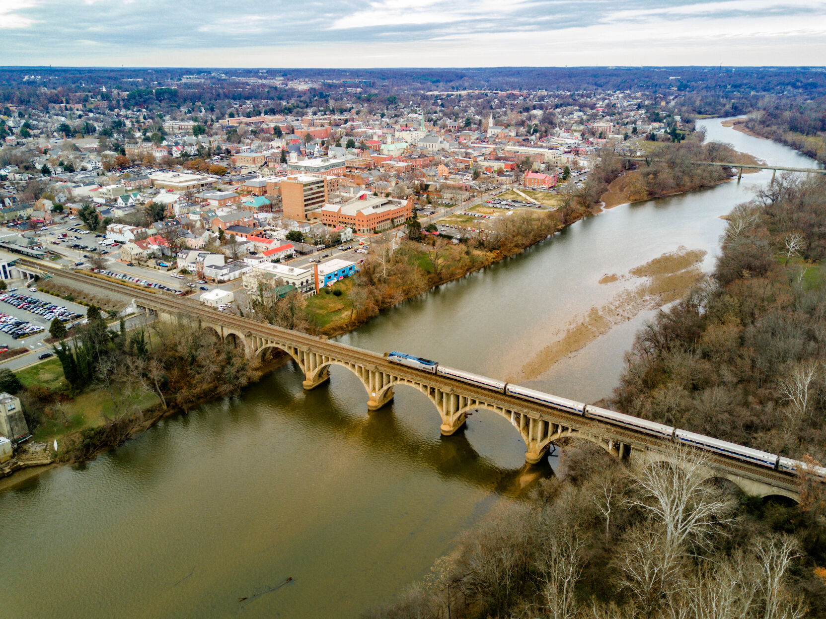
The Rappahannock River is ranked No. 6 on the 2025 list of America’s Most Endangered Rivers. A report cited declining groundwater levels in the Fredericksburg region and a lack of comprehensive water-supply planning in the midst of rapid population growth and expanding industries.
A report released Wednesday from American Rivers, a national nonprofit that monitors the nation’s waterways, says the Rappahannock is a primary source of the Fredericksburg region’s water — and is at risk.
“Increasing demand for surface water, driven by population growth, expanding industries like data centers and declining groundwater levels, pose a significant threat to the river’s health and sustainability,” according to the report at americanrivers.org. “New state regulations require regional water supply plans, but a coordinated basin-wide approach is crucial to safeguard the Rappahannock.”
People are also reading…
It’s the second time the Rappahannock has earned the dubious distinction.
In 2017, the threat of hydraulic fracturing, or fracking, a technique that extracts oil and gas from underground shale rock formations, resulted in the Rappahannock’s inclusion for the first time.
American Rivers has reported on the Most Endangered Rivers for 40 years.
The Rappahannock is the only Virginia river in the 2025 report. The list includes the Mississippi, the Tijuana and Lower Rio Grande, the rivers of Southern Appalachia and the Clearwater River Basin in Idaho, the Susitna River in Arkansas, and the Gauley River in West Virginia.
Those waters face pollution from industrial contaminants related to coal mining or heavy metals, inadequate disaster prevention and planning, unsafe dams or harmful border policies.
The longest free-flowing river in the eastern part of the United States, the Rappahannock River “is an iconic recreational waterway,” according to American Rivers. It supports Virginia’s agriculture, seafood and tourism industries and provides wildlife habitat for a variety of waterfowl and fish species like American shad and Atlantic Sturgeon.
“As use of the river rises, the lack of a comprehensive, basin-wide water supply plan jeopardizes future water availability,” the report states.
Brent Hunsinger, advocacy and coastal programs director for the Friends of the Rappahannock, couldn’t agree more. While he credits the Virginia Department of Environmental Quality for requiring regional water-supply plans, he said five different groups are operating within the Rappahannock watershed.
They’re making plans based on individual needs, not necessarily looking at the demands placed on the entire river, he said.
“Our big thing out of all this is that we want a regional, dynamic, cumulative water supply plan,” Hunsinger said, that takes into account every drop that comes out of the river for drinking water, farm irrigation or industrial uses.
In some cases, the localities working on water plans are grouped together as planning districts, such as in the Northern Neck and Middle Peninsula. But that isn’t the case for the George Washington Regional Commission, which represents Fredericksburg and the counties of Caroline, King George, Spotsylvania and Stafford.
DEQ divided the local region into two groups, said Chip Boyles, executive director of the GWRC. King George and Caroline make up one, while Fredericksburg, Spotsylvania and Stafford make up the other.
Elected leaders in the localities decided to handle the water plans on their own, Boyles said.
The Rappahannock River Basin Commission, established by the General Assembly in 1998, looks at water planning and concerns of water users from Chester Gap in the Blue Ridge Mountains, where the river starts as a trickle, all the way down to the Chesapeake Bay, 184 miles away.
The commission is composed of elected officials and has looked at two different buckets of interest: water supply and quality. The latter had been the focus until recent years, when water supply became an issue, said Eldon James, coordinator.
The renewed interest was primarily driven by the rise of data centers, James said. He acknowledged their demand for infrastructure, including water and electricity, as well as the significant financial resources they bring and the need they serve.
“You gonna turn off your phone? I’m not,” he said, adding that “economic and environmental concerns have to be considered equally.”
American Rivers said Virginia “is already the largest data center market in the world. The intense development in this thirsty industry, as well as continued population growth, have led to increased demand for surface water.”
In addition, localities east of Interstate 95 are being forced to switch from wells to surface-water sources as the Potomac Aquifer declines. The river’s “clean, fresh and cool water” isn’t an infinite resource, said Adam Schellhammer, Mid-Atlantic regional director for American Rivers.
“If we continue to put too much unchecked strain on the Rappahannock, it won’t be able to support the needs of either people or nature,” he said, “and that would be a major hit for Virginia.”
More than 50 million square feet of data centers have been approved, or are in the pipeline in Fredericksburg, Stafford and Spotsylvania. While concerns about water usage are raised regularly by residents and elected officials, “the data center industry in the Fredericksburg region has undertaken a responsible approach to water usage,” said Charlie Payne, a Fredericksburg attorney who’s represented many data center projects.
He said actions include the financing and construction of systems that reuse treated wastewater for industrial cooling. They don’t require potable water or new withdrawal permits from the river.
“To suggest that the data center industry is somehow the cause for alleged impacts to the river is simply short-sighted and clearly driven by special interest who oppose the industry,” Payne wrote in an email.

A 2023 drought dropped water levels in the Rappahannock River so low that people could cross it by foot, stepping on stones that are normally submerged.
The report on the Rappahannock also cited extreme weather patterns that are intensifying droughts. Water levels dropped so low in 2023 that people could walk across the river on stones that normally are submerged.
In addition, Caroline County’s current request for a water intake facility that could extract a maximum of 13.9 million gallons a day from the Rappahannock “could set a dangerous precedent for future water management decisions,” stated the report.
American Rivers and its partners at the Friends of the Rappahannock, the Rappahannock Tribe and the Southern Environmental Law Center urged DEQ, the Virginia Department of Health and other state agencies to develop a comprehensive basin-wide water supply plan that includes input from all interested parties.
American Rivers also recommends studying fish eggs and larvae to determine how they might be impacted from rising salinity levels, if additional water is extracted.
Cathy Dyson: 540/374-5425
Get local news delivered to your inbox!
Subscribe to our Daily Headlines newsletter.